Reality Capture

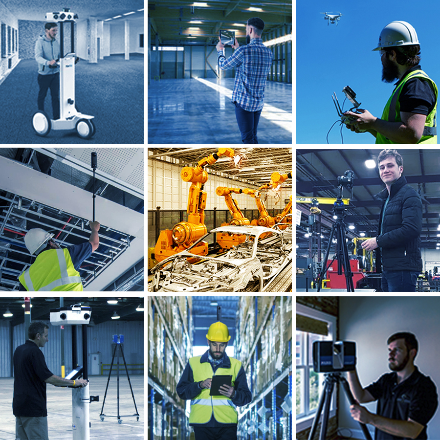
Starting with a Reality Capture of your facility helps leaders solve the “complexity problem” of Industry 4.0 and Smart Factory projects.

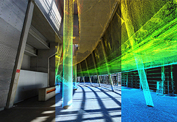
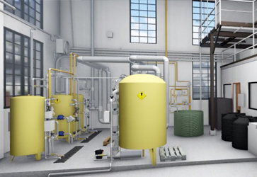
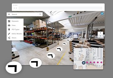
We combine 3D laser scanning, 360º photography, and collected data to provide a snapshot of the facility layout, condition, and components. This step in becoming a Smart Factory jump-starts digitalization and helps you visualize and understand what is happening on the factory floor. From there, the collected data, connectivity, and software integration combine into a single view to help forecast potential issues or find possible ways to enhance the efficiency of operations with further steps towards a full factory transformation.

And it’s not as hard as you may think to get started.

Step 1: Collect Data for Visualization

From 3D point clouds and models to basic floorplans and digital twin visualization, we collect the data that helps clients relate to the building. Immersive experiences and realistic views provide important context for value-based engineering and strategic planning projects.

MAP

Our Simultaneous Location and Mapping (SLAM) technology combines 3D laser scanning and 360° photography and offers a straightforward way to map and measure large buildings and campuses. It’s a fast way to capture a facility, its components, and its condition.

SCAN

The 3D laser scanner captures the environment it scans by shooting a laser in all directions, providing dimensional data as a mass of dots, or a point cloud. Our laser scanning systems capture millions of data points creating a photo-realistic point cloud and digital photo images.

SURVEY

Our traditional asbuilt surveys determine both the building geometry and precise locations of objects like RTLS or IoT sensor devices within the physical environment. We’ll format data and deliverables to integrate with middleware (e.g. X Y Z coordinates in a .txt file, CAD/PDF floorplans, etc.).

IMAGE

360º photography provides a snapshot of the floor layout and current conditions. When built into a 360º Virtual Tour, stakeholders can virtually walk through a digital twin of the space in any browser.

Step 2: Choose Your View

Immersive experiences with photographic information in 360 degrees and even 3D Renderings provide a realistic view and important context for digital twin projects.

POINT CLOUD

POINT CLOUD VISUALIZATION
Our Webshare Platform makes it easy to view scanned data online and virtually “walk through” the building. With the point cloud, you can pull dimensions, get diameters, and transfer that information into CAD drawing or use them for 3D modeling.

IMPORT TO YOUR SOFTWARE OF CHOICE
It’s an ideal way to take a second look at the project scope before modeling begins.

3D MODEL

INDUSTRY-STANDARD FILE TYPES
As our team creates a 3D model from point cloud data, AutoDesk’s BIM 360 Design collaboration tools offer visibility to Revit models as our team builds them. Most currently used Product Lifecycle Management (PLM) applications either ingest these file types or have conversion filters for easy integration.

READY FOR INTEGRATION
Use photo-realistic 3D rendering still images or videos to present your engineering concepts.  Finished models can also be used as source data in Digital Twin Simulations.

Online Views

REAL-WORLD IMAGERY
The 360 visualization platform is feature-rich with VR options, panorama views, reference tags, Google Map integration, and share links. A single click in your browser can take you from your asset database to the object’s location within the virtual tour. The fast, easy snapshot of the facility is perfect for engineering teams to start projects with accurate ideas about inventory and how much space there is.

POINT IN TIME
Do you often have ongoing projects that require you to understand changes over time? We can help with that.

Step 3: Put Your Data to Work

Immersive experiences with photographic information in 360 degrees and even 3D Renderings provide a realistic view and important context for digital twin projects.

Optimize

To make factory simulations relevant, plant leaders have to get their arms around multiple questions. Where is it? How big is it? What’s the distance between? Reality capture provides detail about physical things in the actual space – precisely and visually – so you can validate your model with real-world data.

Innovate

Innovation Programs often require detailed background information and ongoing status updates and continuous-improvement reporting. Digital Twins make it easy to keep stakeholders in the loop and project participants accountable and a thorough view of the circumstances that surround your processes.

Propose

Capital Improvement efforts are a much-discussed and debated expense and most Industry 4.0 program leaders have few internal resources to make big things happen. You don’t have to invest internal resources to get your factory “smart” because we’ve got the tools, the field team, and a diverse array of 2D, 3D, and 360º reality capture options to help you get started.

Starting your Industry 4.0, Manufacturing IoT, Logistics Improvement, or Facility Optimization project? Build a strong foundation using Reality Capture.